
Impact of new technologies on marine information systems
|

I was fortunate to get the opportunity to attend the International Conference on Marine Data and Information Systems - IMDIS 2008 - held in Athens, Greece where I presented a poster on behalf of SAEON.
The aims of the conference were to report on the current state of marine environmental information systems and associated metadata and standards, and the future influence new technologies may have on the development of the systems.
To facilitate these aims, the conference was divided into four sessions: Marine Environmental Databases; Standards and Interoperability; User Orientated Services and Products; and Tools for Education. The topics were well covered by the presentations and posters of the many delegates - there are 236 pages in the Book of Abstracts with at least that many delegates and perhaps five times more co-authors that did not attend.
The majority of the participants were from the northern hemisphere countries, such as the European Union, but also from Russia, North America and Canada. Strangely, there were few, if any, from the southern hemisphere apart from three South Africans.
The poster I presented (as co-author with Dr Juliet Hermes, Manager of the SAEON Egagasini Node, Avinash Chuntharpursat, SAEON’s Information Management Scientist and SAEON Managing Director Johan Pauw) was titled “Towards a data management system for long-term monitoring of oceans around Southern Africa”. It gave an overview of the role the Egagasini Node had to play in the long-term monitoring of the marine offshore region of South Africa.
In the poster I also displayed the platforms, databases and technologies that the Egagasini Node envisages as the solution to implement this mandate. From the presentations, I gathered that other systems were implementing the same solutions as we had planned, and in fact, some solutions were moving their technologies away from ESRI to open source platforms like PostgreSQL, GeoServer and GeoNetworks. In this regard, I found common ground with other delegates, and managed to have interesting conversations with Irish, Canadian and French teams.
Technologies and standards
The conference was very useful in that it gave me in idea of the technologies and standards used in marine web-based GIS by the rest of the world, what problems they are encountering, and what directions they foresee these systems to take in the future.
The main results that I derived from the conference were that:
- there is a move away from commercial products to open source products;
- the web-based GIS systems are operational, and pretty complex, but the technologies are far from mature and stable;
- the standards and metadata issues are still unresolved, and there is slow (but definite) progress toward general acceptance of standards;
- more interconnectivity and information exchange is needed between the systems.
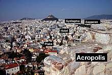
On the social side, being something of a history fanatic, I visited most of the historical sites in Athens during the rest of my stay. One of the best parts of town was an area called the Plaka. It is a very old area in among the ancient ruins, very touristy, but the outdoor eating is excellent. Each little restaurant has outdoor tables. I went there often for dinner and just sat and watched the world go by.