
SAEON’s 2009 Enrichment Excursion: Delving into the past to shed light on the future
|
Archaeology is also known as archaeometry, a discipline which includes scientific enquiry and methodology. It involves ‘reading’ the landscape and the ‘artefacts’ that are found in it. It combines the sciences (chemistry of rocks, the build up of rocks, radio carbon dating, etc) with many disciplines of study such as oral history. It provides a history when there are no documented histories. It links with geography through geomorphology, map work and climate science. We are able to say that global warming and the associated increase in carbon dioxide levels are at an unprecedented level exactly because of archaeological records. Prior carbon dioxide levels in the atmosphere due to carbon dating of carbon dioxide in rock strata deposited many years ago have been determined through archaeological studies. From these excavations, insights into earlier life on earth as well as what foods our ancestors ate, what they used from the environment to survive and how they lived teach us how the earth provided for those early human beings that lived in a sustainable way. Starting from a hypothesis, archaeologists try to make sense of the world as it was in a scientific way. They follow scientific method to test whether hypotheses are true. Their insights help us to make informed choices about how we as human beings should be treating the earth in order to live in a sustainable way. Remarkably, this field of study also looks at cultures and ways of living, which combines the sciences and social studies to present a holistic view of life and the actual decisions that we need to make to enable us to continue life as we know it. More and more Stone Age cultures are showing that people had a healthy respect for the environment and for each other. It can be argued that archaeology is monitoring of the environment and people in its grandest form. |
|
|
|
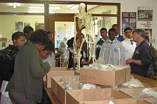
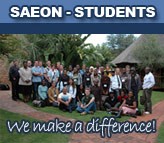
During the previous school vacation, SAEON Fynbos Node Education Officer Hadley Lyners, three educators and thirteen learners from three high schools were privileged to be introduced to archaeology by world-acclaimed archaeologist Prof John Parkington, who heads the University of Cape Town’s (UCT) Department of Archaeology.
Inside the ‘Time Machine’, learners were subjected to an amazing teaching and learning resource that will amaze future learners for years to come. Prof Parkington was ably supported by Dr Simon Hall, an historical archaeologist; Ms Jenna Lavin, a palaeontological Master’s student and Mr John Mountain, a most passionate field guide from the Clanwilliam Living Landscapes Project.
The programme was presented to educators and learners alike in a professional and structured way which knitted the landscape together by linking various learning areas. Hadley Lyners assisted the presenters to make links to biodiversity and real-life issues.
The objective of the visit was to make young learners aware of the historical significance of traces of the past that form the landscape, to promote the concept of an integrated cultural and natural landscape, and to increase the conservation thereof. This implies learning to read the landscape, becoming competent in the documentation of archaeological and historical sites, and understanding the long history of the occupation and impact of humans on the fynbos landscape of the Western Cape.
The learners and educators who participated in SAEON’s 2009 Enrichment Excursion were exposed to lectures and information sessions — coupled with report-back sessions — after field trips. The field trips were structured around reaching the following outcomes: the ability to read a landscape by recognising visible patterns and learning to explain them; the ability to read maps of various scales; an awareness of the significance and fragility of natural and cultural resources; some practice in preparing maps and charts; experience in collecting and manipulating numerical information; and the ability to build displays that express the results of their work.
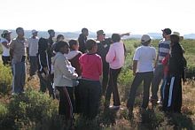
Day one: Reading the landscape — an introduction to landscape education
The learning experience included understanding the topographic basis of landscape, the significance of stratigraphy and TIME. How did the Cape Folded Mountains get folded? What is the significance of soil differences in landscape differentiation? What are the characteristics of a Fynbos landscape? What niches and habitats are available for plants, animals and people?
Participants were taken along the Pakhuis Pass road to investigate the complex sequence of sandstones, shales and glacial deposits. The stratigraphic sequence is visible and the impacts of different rock types on soils and vegetation are clearly evident.
Day two: Fossils and the ancient landscape
Learning focused on understanding the notion of landscape traces, including fossils. How do we know that the Cederberg landscape was different in the past? What can local fossils contribute to the notion of evolution? How do we research and interpret prominent features of the landscape? What are “heuweltjies” (small hillocks), for example, and how old are they?
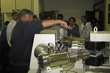
We visited the fossil localities where 450-million and 250-million-year-old fossil animal remains can be seen. The local heuweltjies can be mapped and investigated through botanical and geological means.
Day three: The earliest modern people
Who were the first human occupants of the Fynbos landscape of the Cederberg? When did modern people arise and where? What do their artefacts and remains look like? How do we know how old these traces are?
Visits were paid to the important site of Diepkloof on Verlorenvlei, where the artefacts and food waste of the earliest modern people in the Cape can be viewed. There are also earlier sites where the artefacts of pre-modern people can be seen and mapped.
Day four: Rock paintings as traces of activities and beliefs
Who were responsible for the rock paintings of the Cederberg? Why did they paint particular animals and not others? Where did local hunters and gatherers choose to live and paint? What happened when domestic animals were introduced?
We visited Warmhoek, where the rock paintings illustrate a very selective choice of subject matter. We were told that the paintings relate to what was in the mind of painters, not in their stomachs. We looked at historic and ethnographic records to help us gain a better understanding of the subject matter of these paintings.
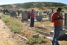
Day five: Colonial presence, its impact and traces
How did colonists impact local hunters and herders? How did their notion of landscape differ from that of the people they replaced? What role did renaming play in the reinvention of the landscape by colonists? What traces of indigenous place names still survive today?
The graveyards of Clanwilliam provide an excellent opportunity to study the impact of colonial society, as do the churches and farms in the area. Maps are an invaluable tool to provide insight into the way invasive societies seek to dominate by renaming, and thus claiming, a landscape.
During the excursion learners not only acquired new knowledge and skills, but their attitudes and values were also challenged. Prof John Parkington allowed Hadley Lyners and three educators to contribute towards tailoring a programme relevant to the learners’ scholastic needs. Upon interrogation of the Life Sciences curriculum documents it was found that archaeology caters very well for reaching Learning Outcomes 1, 2 and 3. They are scientific enquiry (investigation); constructing scientific knowledge; and applying life sciences in society.
History was made when the learners initiated a long-term monitoring project at the Clanwilliam Living Landscapes Project1 (CLLP). From now on the flowering time of 15 vygies will be monitored on 1 October every year to observe whether seasonality changes are taking place. The flowers will indicate whether this is happening like they used to tell the /Xam people (hunter-gatherers/ “Bushmen”) when it was “uintjiestyd” (onion time). /Xam people used to harvest corms (underground bulbs) from watsonias and other corms based on what the flowers were telling them.
The CLLP demonstrated values and attitudes from which others could learn. Throughout the excursion learners were encouraged to share what they have. SAEON’s environmental outreach officer was guilty of bribery by offering sweet delectables as prizes to those who could answer questions related to the day’s learning. Heart-warming was the notion of sharing afterwards.
Many new friendships were forged and the learners astounded presenters and educators alike with the quality of their presentations on the last day.
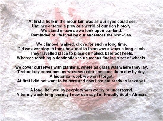
We conclude with a poem written by Donna September (grade 10) from Excelsior High:
1 The Clanwilliam Living Landscape Project is located at 18 Park Street, Clanwilliam. For further information about the Clanwilliam Living Landscape Project contact Professor John Parkington on (021) 650 2353, e-mail jep@age.uct.ac.za or visit http://www.cllp.uct.ac.za/