

All in the name of science
|
In these times of concern for the environment and efforts to combat global climate change, planting trees is highly regarded. Cutting down trees is not. However, this is exactly what SAEON’s Ndlovu Node has been doing for the past three years. All in the name of science, of course.
Trees play a vital role in the regulation of the flow of carbon and water, between ecosystems and the atmosphere. The amount of carbon stored by trees and the rate at which trees grow and absorb more carbon out of the atmosphere is vital information, both for carbon credit projects and for global climate models that inform society of how our climate is changing (and how much more it is likely to change in future).
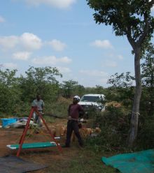
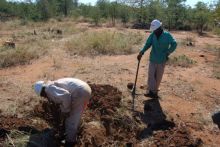
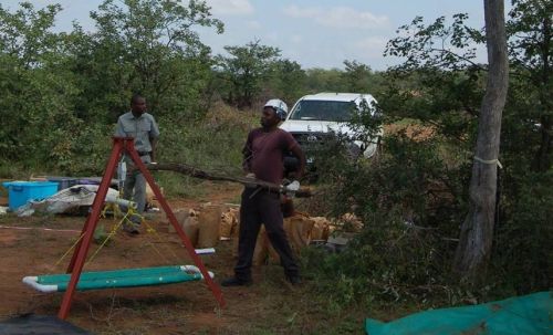
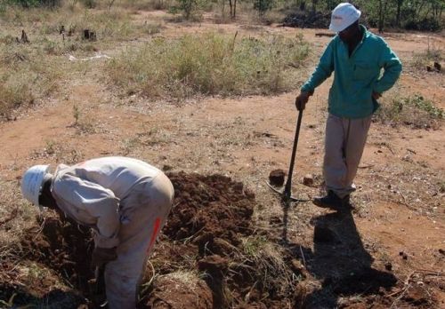
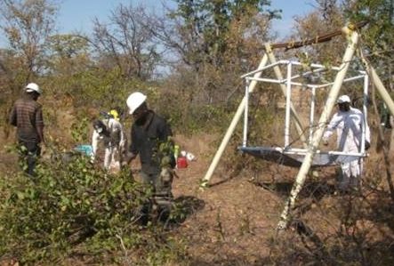
In order to provide more of the basic data upon which these complex models are built, the SAEON Ndlovu Node has been “harvesting” trees at a mining site. Harvesting involves making detailed measurements of a tree’s dimensions before cutting it down and weighing it. By measuring trunk diameter and matching this with the tree’s weight, future estimates of carbon stored in living trees are made at other sites where harvesting is not an option (such as inside Kruger National Park). For selected trees, roots are also dug up to be weighed, as nearly 30-50% of a tree’s weight (and carbon) is located below ground.
Harvesting a range of tree species, in different types of ecosystems, is needed in order to make reliable estimates of biomass and carbon stocks over large areas.
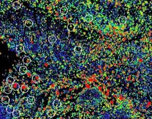
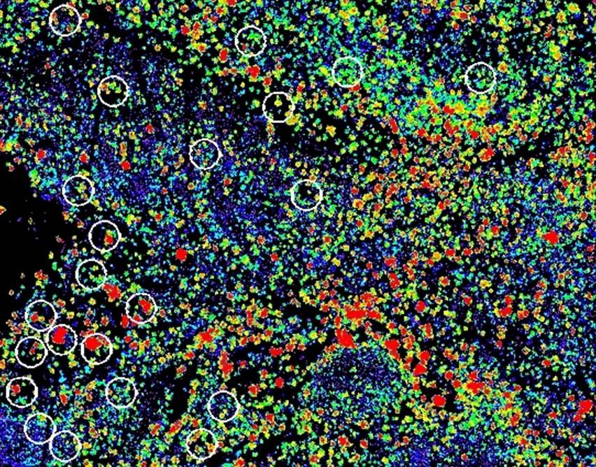
Using airborne lidar to estimate tree biomass
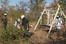
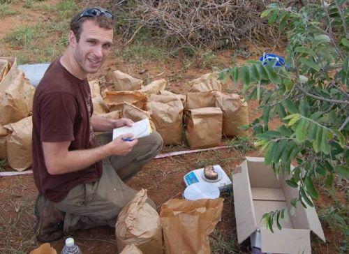
This past summer, the Node’s “tree harvesting project” was given a major boost through collaboration with Matt Colgan, a PhD student from Stanford University in the USA. Matt is using cutting-edge technology, known as “airborne lidar” to estimate tree biomass from above. The LIDAR1 data was obtained from the "Carnegie Airborne Observatory" - a customized lidar sensor fitted to a light aircraft - which was especially flown over the Node’s tree harvesting site.
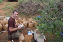
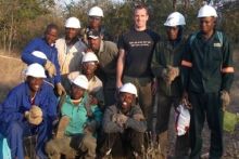
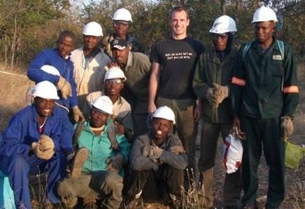
In order to calibrate the lidar data, Matt then harvested thirty plots containing over 3,000 trees from the site, with help from a team of 12 field assistants, and in collaboration with the Node. His results will provide valuable data for a range of common tree species, as well as a new method to calculate tree biomass and carbon stocks over large parts of the country, including much of the Kruger National Park.
The Node’s “tree harvesting project” has been conducted on the Pompey property of the Palabora Mining Company, which is currently being strip-mined. The vegetation consists of natural savanna (bushveld) that is in an undisturbed state, and therefore ideal for this type of study. The mine has allowed SAEON staff and collaborators onto their property to harvest trees before they are cleared for mining.
1 LIDAR (Light Detection And Ranging) is an optical remote sensing technology that measures properties of scattered light to find range and/or other information of a distant target. The prevalent method to determine distance to an object or surface is to use laser pulses. Like the similar radar technology, which uses radio waves, the range to an object is determined by measuring the time delay between transmission of a pulse and detection of the reflected signal. LIDAR technology has application in Geomatics, archaeology, geography, geology, geomorphology, seismology, forestry, remote sensing and atmospheric physics. (Wikipedia)


