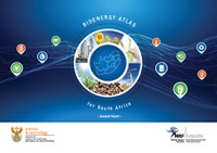
The electronic spatial database of the Risk and Vulnerability Atlas is live!
|

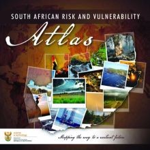
The eagerly awaited electronic spatial database of the South African Risk and Vulnerability Atlas (SARVA) is ready for use by its stakeholders.
This follows a period of concerted effort by participating scientists in the SARVA project and the SAEON consultant responsible for the architecture of the electronic spatial database, Wim Hugo. Stakeholders are now able to access the data and maps contained in the database via the SARVA website: www.rvatlas.org
The sophisticated, web-based electronic database can be searched in many ways, and delved into at many levels of simplicity or complexity. The system is free and 'open access'.
Bridging the gap between science and policy
The SARVA project was designed by the Department of Science and Technology (DST) to be a "technology transfer" mechanism into their scheme for the 10-year Global Change Grand Challenge. The intention is to bridge the gap between global change science and global change policy by improving access to global change information.
The atlas data are updated on a regular basis. In principle, all projects funded through the DST's Global Change Grand Challenge will be required to place their findings and data into SARVA as one of their delivery requirements, in addition to the usual science delivery channels such as publishing in the scientific literature.
SARVA will also serve as a vehicle for information exchange between researchers, and was pre-populated with many important datasets that have already been widely used.
Risk and vulnerability information
Some examples of information to be found in the system include projections of climate change at local scales, by different models, for the 21st century; assessments of the risk of coastal flooding due to sea level rise; probabilities of drought and water shortages; population densities; economic activity and poverty levels.
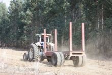
Themes are being populated and maintained by convenors/convening groups, including Socioeconomic, Settlements, Weather and Climate, Groundwater, Surface Water, Forestry, Biodiversity, Air Quality/Emissions and an emerging theme on Climate Change impacts/adaptation.
The Coastal/Marine theme is in progress and is likely to be linked to the Coastal/Marine Atlas being established by the Department of Environmental Affairs. The Geohazards theme will be linked to the Geohazards Atlas being established by the Council for Geosciences.