

Establishing a long-term ecological research programme for estuaries
|

SAEON’s Elwandle Node, in collaboration with the Department of Water Affairs (DWA, Resource Quality Services), is in the process of establishing a comprehensive long-term ecological research and monitoring programme (LTERM) for selected estuaries (see table below).
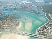
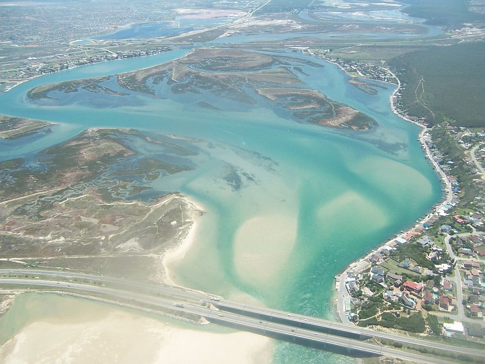
Except for the Orange River Mouth, Knysna and the St Lucia/Mfolozi systems, all the estuaries indicated in the table are in the Eastern Cape. Although SAEON Elwandle has a national mandate, current budgets dictate that efforts be concentrated in and around the Algoa Bay / St Francis Bay Sentinel Site. Short-term future plans include an expansion up the Wild Coast.
|
Monitoring projects
The SAEON Estuarine LTERMP will consist of the following monitoring projects per estuary:
- A continuous monitoring platform (CMP) consisting of conductivity/ temperature (CT) loggers deployed in the lower, middle and upper reaches of an estuary.
- Monthly pelagic ecosystem sampling at four to six stations along the length of the estuary. Sampling involves physico-chemical variables (temperature, salinity, oxygen, pH, turbidity, secchi depth and light attenuation), total chl-a biomass and nutrients (ammonia, NOx-N, PO4-P).
- Monthly high resolution salinity/ temperature run up the length of the estuary at ~100 stations.
- Annual bathymetric survey every 100 - 200 m up the length of the estuary.
- Survey of sediment particle size, organic content and metal concentrations (every three to five years).
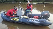
- Episodic sampling - SAEON will be on standby to sample episodic events such as floods, storm surges, pollution, plankton blooms, etc.
In addition to the water column and benthic sampling described above, SAEON is also involved in the following long-term monitoring projects - salt marsh monitoring in the Orange, Knysna, Kromme and Swartkops estuaries, and sediment elevation monitoring using a Rod Surface Elevation Table in the Knysna, Kromme and Swartkops estuaries.
The first results from the in situ Conductivity/Temperature loggers deployed in the Kromme Estuary (Figure 1) and the St Lucia/Mfolozi estuarine system (Figure 2) provide an important insight into the natural variability of the systems and the response of these estuaries to hydrodynamic changes such as flooding and mouth closure.
|
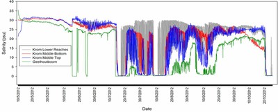
The salinity loggers managed to capture the impact of the highest recorded rainfall in 60 years on the normally freshwater-starved Kromme Estuary (Figure 1). Although the salinity was high during initial deployment, it was not hypersaline (~40 psu) as was normally the case in the upper reaches, indicating that some freshwater had entered the estuary from previous rainfall events earlier in the year. All four loggers captured a similar response to the freshwater events, although the magnitude and extent of the impact varied depending on location. The variability was highest near the mouth due to the tidal influence.
|
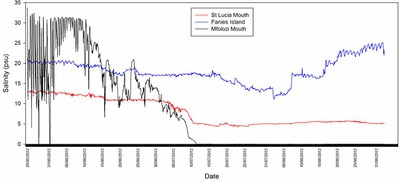
The Mfolozi Estuary was open to the sea when the logger was deployed and the tidal influence is clearly discernible in Figure 2. After the mouth closed, the system gradually became fresher and it remained fresh up until the first week in September when the logger was serviced. The impact of the merging of the Mfolozi mouth with the St Lucia mouth can be seen in the salinity data from the St Lucia mouth logger (red line in Figure 2). The influence was not as great as was expected, but the connection was not maintained for very long before the mouths separated naturally once again. The salinity at Fanies Island increased in August as the lake levels decreased. The drop in salinity at the end of the graph was due to a rainfall event (80 mm in a few hours) that increased the lake levels.
The data provided by the CMP and LTERM programme will provide a solid platform around which estuarine scientists can design their research projects. The programme will also provide valuable data that can be used to inform the determination of the Estuarine Ecological Reserve and monitor the implementation of the reserve.
Data will be made available to anyone that registers their project with the SAEON Elwandle Node. Eventually the data will be made available via the South African Estuarine Information System (SAEIS) database.


