

Repeat vegetation surveys - opportunities for answering new questions within the global change context
|

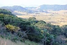
Driving through the iSimangaliso Wetland Park today, it is hard to believe that not so long ago large parts of this landscape were covered with plantations of alien pine trees …
Listed as South Africa’s first natural World Heritage Site in 1999, and now managed by the iSimangaliso Wetland Park Authority, conservation management operations in the park are undertaken by Ezemvelo KZN Wildlife through a co-operative governance agreement.
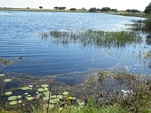
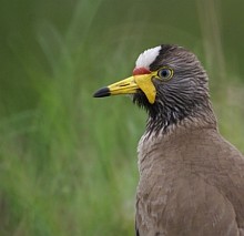
The area boasts spectacular scenery, unique ecosystems, rich biodiversity and a range of rare and threatened species. Prime game viewing and the combination of terrestrial, wetland, estuarine and coastal features, including some of the highest vegetated coastal dunes in the world, add to a unique sense of place, making the area an attractive tourism destination.
Managing natural assets and benefits for South Africans
The area supports a substantial and diverse tourism industry, creating jobs for neighbouring traditional communities, as well as significant ecosystem services. The primary purpose of the iSimangaliso Wetland Park is to maintain these ecosystem services.
In addition to the conservation objectives, an important goal of the iSimangaliso Wetland Authority is to stimulate economic development of adjacent regions. The ecosystem services provided by the system support natural resources of both subsistence and commercial value, sustaining people’s livelihoods.
By way of example, the iSimangaliso Wetland Park encompasses two of the most important estuarine systems in South Africa. These are Kosi and the St Lucia/ Umfolozi system which, as fish nurseries, support the national marine fisheries of South Africa.
Appropriate management of the natural capital assets provided by the system will assist in supporting the economic development goals of the region.
History of disturbance
This seemingly pristine landscape has a history of human activity associated with disturbance.
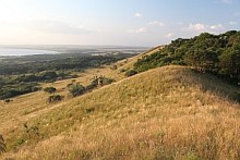
On the eastern shores of Lake St Lucia, extensive pine plantations were established in the late 1950’s, on areas of land that had originally been cleared for slash and burn agriculture and to provide fuel for iron smelting.
Long-term research that was initiated in about the 1940’s in areas such as Cathedral Peak and Jonkershoek, highlighted the negative impact that plantations can have on hydrological functioning and water resources. Within the St Lucia system this impact would be manifested in the ground-water resource.
In recent years, an understanding of the value and ecological significance of the coastal ground-water resource and the biodiversity significance of the area has been gained through research and monitoring initiated in the mid 1970’s by the then Natal Parks Board (now Ezemvelo KZN Wildlife). Recognising that ground-water drives important ecological processes within the system, concern over the impact of the pine plantations grew, culminating in a Cabinet decision to progressively fell and eradicate these plantations from 1991 onwards and allow for the natural recovery of the area for ecotourism and conservation purposes.
With the removal of alien pine plantations, recovery of natural hydrological functioning may be expected, but the nature and rate of vegetation recovery post felling were less certain. In 1998 a study looking at vegetation succession after felling pine plantations was conducted by Barry James of the University of KwaZulu-Natal. The main question he examined was what type of natural vegetation established on previous plantation areas. If the plantation had been adjacent to a grassland or a forest, would this influence the character of vegetation development? It was important for management to know whether a grassland or a forest was likely to develop because it would influence management decisions such as the fire regime.
James collected vegetation data from areas logged in different years, areas still under plantations, and areas of natural vegetation adjacent to each. From this data, a “space-for-time” substitution could be constructed of successional changes in vegetation.
A clear-cut finding was that the direction of vegetation change was strongly influenced by the nature of the indigenous vegetation adjacent to the plantations as well as the exclusion of fire. If a plantation had a forest growing next to it, it already contained many forest tree species before it was logged. These were, however, absent or scarce if grassland was adjacent. The latter rapidly trended toward grassland and soon carried fire, which served to further promote grassland. A follow-up survey five years later (Dalton 2003) provided further information in accord with this pattern of change.
Long-term observation
Can we expect such a pattern of change to be maintained, or for external factors such as fire to ultimately force the vegetation in a single direction? Questions of this nature can only be properly addressed through long-term observation. SAEON has committed to maintaining this observation in order that prediction can be made about vegetation cover for interpretation of ground-water use by vegetation.
A further important issue for conservation is the extent and rate of recovery of biodiversity on previously grossly disturbed sites. In addition, continued monitoring of plots that were initially located in natural vegetation now provides an opportunity to determine if vegetation change has occurred in response to other management or external factors. These factors include land use, management, and climate change.
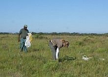
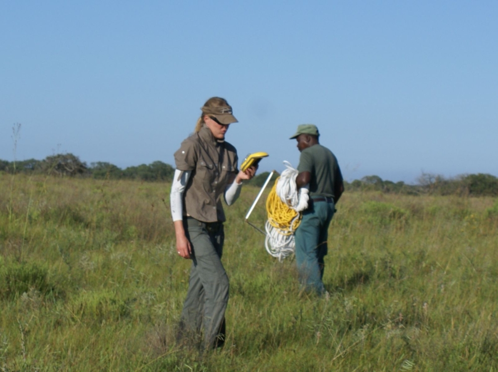
With this broader picture in mind, SAEON’s Grasslands, Forest and Wetland Node recently resampled these vegetation plots, using the same methods originally used, marking the 3rd sampling event in 14 years. The work was conducted by Danne Joubert, a Field Technician at SAEON’s Grasslands, Forest and Wetland Node, with invaluable assistance provided by Jeremiah Gumbi, a Research Technical Assistant from Ezemvelo KZN Wildlife. The project is registered with iSimangaliso Wetland Park Authority and Ezemvelo KZN Wildlife.
Understanding impacts on ecosystem functioning
The data emanating from this type of work is no longer merely of conservation relevance, but has the potential, in combination with additional monitoring initiatives, to be used to explore questions regarding ecosystem resilience to disturbance as well as land use and climate change impacts on ecosystem functioning. Understanding the interplay between vegetation communities, land use and ground-water within this coastal aquifer system in the context of global change is becoming increasingly important in light of land use changes in the adjacent, unprotected but ecologically linked areas.
SAEON is grateful to the iSimangaliso Wetland Park Authority for hosting and facilitating the project and would like to thank Ezemvelo KZN Wildlife for the field assistance and support they have provided.


