
Labour-intensive science at a regional scale? SAEON joins the new Kruger-to-Canyons Environmental Monitors Programme
The National Government's Expanded Public Works Programme (EPWP) has created many initiatives that aim to improve the management of natural resources in South Africa. These generally involve labour-intensive operations to implement desired management outcomes, modelled along the lines of the well-known Working for Water Programme.
Could EPWP funding also be used to monitor the state of natural resources, and contribute to the more scientifically orientated objectives of organisations like SAEON? The SAEON Ndlovu Node is exploring this possibility by participating in a new EPWP venture called the Environmental Monitors Programme.
Environmental monitors are unskilled workers recruited from previously disadvantaged communities, who are trained to record observations on key environmental changes in the area where they live. Their observations are recorded on hand-held GPS units, and the data is then brought together for archiving, analysis and distribution - to both managers of natural resources and the environmental science community.
Monitoring environmental changes in the K2C Biosphere Region
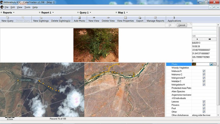
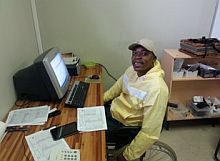
In July the SAEON Ndlovu Node employed six environmental monitors, who form part of a team of 86 monitors recently deployed throughout the Kruger-to-Canyons (K2C) Biosphere Region. SAEON staff members Tony Swemmer and Rob Taylor have been involved in the design of the data collection protocol and software used by most of these monitors, and the Node is hosting one of five data collators who are responsible for downloading and collating data from them.
|
|||||||||||||||||||||||||
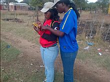
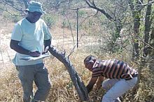
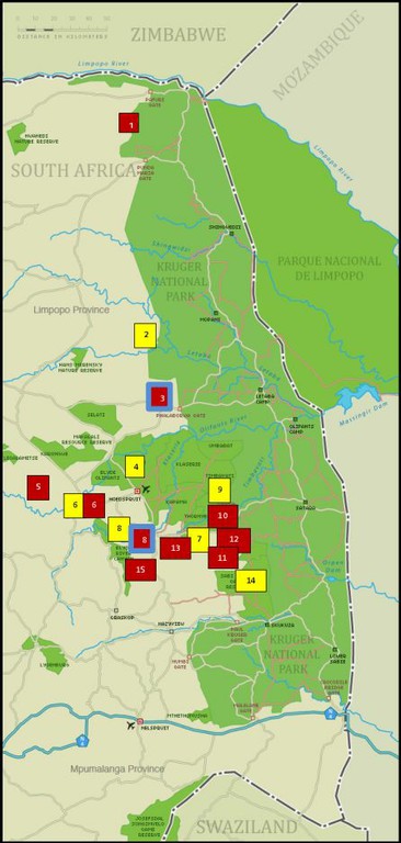
Monitors have been deployed both in protected areas and rural areas (see map). In the case of the latter, monitors where recruited from villages where they live, and simply walk from home to patrol the surrounding rural rangelands daily, resulting in a highly cost-effective means of monitoring areas that are difficult to access (both physically and culturally) for most environmental scientists.
Two of the SAEON monitors are working in the rural lands of the Makhushane Tribal Authority on the outskirts of Phalaborwa, while three work from the villages of Craigieburn and Maloro, located in the foothills of Mariepskop Mountain, a developing observatory for monitoring environmental change on South African mountains.
The monitors are currently using Trimble Juno GPS units, supplied by the programme, for recording data in the field. CyberTracker, a free South African software product, was selected as the application for data capture and collation.
Themes
Data is collected according to five themes, with the exact variables recorded by each monitor customised according to the land use and biophysical environment where they work. The five themes, each encompassing a range of scientific questions about major environmental changes occurring in the region, are:
- protected areas management (focused on data required to manage protected areas more efficiently);
- rangeland monitoring (focused on the state of natural resources and biodiversity of terrestrial ecosystems);
- freshwater monitoring (focused on the water quality and biodiversity of surface water resources);
- environmental health (focused on disease and other factors affecting the health of people and animals); and
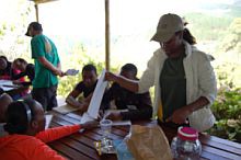
- community engagement (focused on socio-economic trends in rural communities).
Host institutions
SAEON is one of ten host institutions who have employed environmental monitors within the Kruger-to-Canyons Biosphere Region, all through a partnership with SANParks, who is implementing the programme as one of the new EPIP (Environmental Protection and Infrastructure Programmes) of the Department of Environmental Affairs.
The other host institutions are Mpumalanga Tourism and Parks Agency, private nature reserves (the Timbavati, Olifants-West and Sabie Sands), the Southern African Wildlife College, the Agricultural Research Council, the Universities of Pretoria and Witwatersrand and the K2C Biosphere Reserve (a non-profit organisation that is developing the UNESCO K2C Biosphere Region).
|
|