
Understanding the local oceanography of False Bay
|


Most Capetonians enjoy the surf and sun in and around False Bay. However, this region is generally overlooked in terms of knowledge of its oceanography compared with other regions of South Africa.
In 2015 a University of Cape Town (UCT) PhD candidate, Renae Logston, started to investigate False Bay. Her project is looking at environmental effects on the marine trophic levels within the bay.
The aim of this study is to explore the role oceanographic variables, including temperature, currents, wind and thermocline, may have on influencing the distribution of plankton and small pelagic fish in False Bay. The study will also examine how the most recent El Niño-Southern Oscillation (ENSO) affected this ecosystem.
|
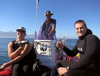
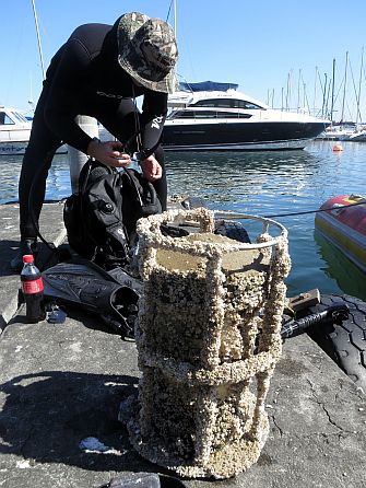
For data collection, Renae has been aided by UCT, the Institute of Maritime Technology (IMT), the Council for Scientific and Industrial Research (CSIR) and SAEON. The project uses highly specialised equipment in the form of Acoustic Doppler Current Profilers (ADCPs), and Conductivity, Temperature and Depth instruments (CTD) to collect in situ data.
The bay currently has three ADCPs located in the western, northern and eastern shores. These instruments collect bottom temperatures, currents, waves and backscatter. The ADCPs are serviced every three months and during this service Renae collects CTD profiles from each ADCP site and from across the bay. To supplement this data set, she also uses daily South African Weather Service (SAWS) wind data, NASA’s MODIS Aqua Sea Surface Temperature and Chlorophyll Concentration data.
|
What happens beneath the waves...
...is profoundly influenced by conditions above. The winds blowing over the surface of the ocean drive the circulation and upwelling in False Bay, and generate local wind-waves which interact with swells originating far offshore in storms over the deep ocean.
Local winds are in turn driven by a complex interplay of large-scale weather systems and rugged coastal topography. The Cape Peninsula and Kogelberg mountain ranges act to steer, accelerate and temper both unrelenting summer southeasterlies and rain-laden winter northwesterlies, weaving intricate and ever-changing patterns at the bay’s surface.
UCT-based MSc student Mark Jacobson is undertaking a study of the winds in False Bay using the Weather Research and Forecasting (WRF) atmospheric modelling system, a state-of-the-art numerical model with wide-ranging applications from real-time weather forecasting to regional climate modelling. The study has two main objectives: firstly, to simulate the wind field over False Bay for potential application to a wave model that has been developed at the CSIR; and secondly, to investigate the role of topography in influencing local winds in False Bay under different synoptic atmospheric conditions.
|
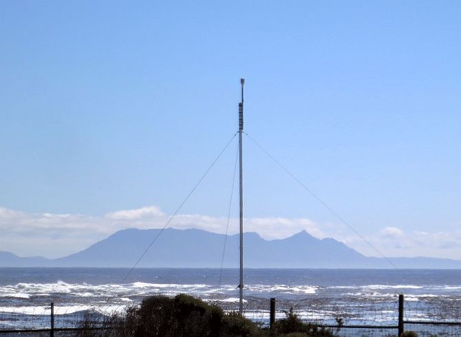
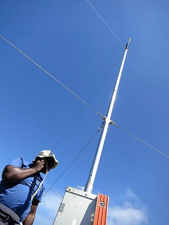
Observational weather data are required for verification of model results and to compare different models and different model configurations. To this end, SAWS wind data have been obtained for Cape Point, Cape Town International Airport and Strand, whilst IMT has provided wind data for Roman Rock.
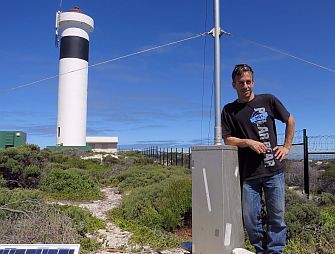
Mark has additionally been involved in the deployment of a weather station at Cape Hangklip Lighthouse, thus providing the project with full (if sparse) coverage of the False Bay coastline. The weather station was supplied by IMT.