
Introducing the Lower Orange River Riparian Project
|


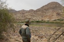
Reclining on the banks of the lower Orange River at Augrabies, with the sun setting over this rocky desert landscape, one cannot help but be amazed at how the river’s water has flowed for about 2 200 km from the highlands of Lesotho, through a diversity of landscapes, to eventually spill over the Augrabies Falls.
From here the water flows through the most arid part of South Africa to its final destination - the Atlantic Ocean.
|
As far back as primary school we learned about the life-sustaining and economic importance of this, the largest river system in South Africa. It continues to capture the imagination of those lucky enough to visit the lower reaches of the river, where the lush green riparian vegetation is in stark contrast with the surrounding desert landscape. The lower Orange River is truly magnificent.
Naturally, the river’s flow has varied with time from apocalyptic-like floods to (believe it or not!) running completely dry. Humans have captured and tamed the river as best they could. It started off with a few reservoirs and weirs too small to stop floods or prevent drought, such as the Boegoeberg Dam (20.7 million m3) that was completed in 1933.
Tipping point
A tipping point in human development along the Orange came with the completion of the Gariep Dam in 1971 - the largest reservoir in South Africa at 5 348 million m3. The hydrological regime downstream would forever be changed.
Today, there is a complex system of reservoirs, transfer schemes and irrigation canals. This includes the Vanderkloof Dam, also constructed during the Orange River Project in the 1970s, the Katse and Mohale dams, constructed as part of the Lesotho Highlands Water Project (1990s to present) and the Vaal Dam (originally constructed in the 1930s, but raised twice since), controlling the Orange River’s main tributary, the Vaal River.
|

As a result, the seasonal nature of flow in the lower Orange River has been all but eliminated and small floods are captured by reservoirs so that they no longer wet the floodplain as frequently as before. This, along with the development taking place along its banks, is why most of the lower Orange River riparian zone has been declared a threatened ecosystem.
SAEON study
But what exactly are the effects of the altered hydrological regime on the riparian zone? This is what the SAEON Arid Lands Node, in collaboration with SANParks and the University of the Witwatersrand (Wits), set out to discover in the Lower Orange River Riparian Project (funded by SAEON and the Botanical Education Trust).
Making use of flow records and aerial photographs, principal investigator Marco Pauw (SAEON Arid Lands Node field technician and PhD candidate at Wits) aims to determine how the riparian vegetation between Augrabies Falls and Richtersveld changed in response to the altered hydrology. Several other factors, such as Prosopis invasion and land use, are also taken into account. This desktop component is complemented by in-situ data collection.
|


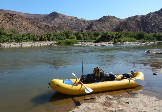
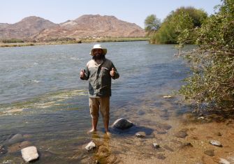
In October and November 2017, Marco, with Tshililo Ramaswiela (fellow field technician) and Stefan Goets (intern), collected data on the riparian vegetation in Augrabies Falls National Park and along the banks of Blouputs1 and Riemvasmaak2 as well as at Raap-en-Skraap farm. This represents the first attempt to collect data on and describe the riparian vegetation communities along the lower Orange River on this scale, mainly due to logistical difficulties. Some areas are only accessible by boat.
The Arid Lands Node team will continue to brave extreme temperatures, headwinds, dense and thorny vegetation, and biting insects in 2018. They will visit more places with exotic names such as Onseepkans, Pella and Vioolsdrift, and eventually the iconic Richtersveld.
Hopefully, they will gain better insight into the ecology and long-term changes in the riparian zone along the lower Orange River, which sustains biodiversity and provides important ecosystem services in a truly harsh environment.
1 Blouputs is a settlement consisting of several grape and citrus farms on the south bank just downstream of Augrabies Falls.
2 Riemvasmaak is a large communal area that borders the Orange River north of Augrabies Falls National Park and Blouputs.