
From paper plotting activities to layering using SAEON data - new skills for educators
|


|
What inspired SAEON to conduct GIS Educator workshops?
In 2014, GIS technology was introduced into the Curriculum Assessments and Policy Statements (CAPS) in high schools across South Africa. It is a relatively new field of teaching and learning in Geography.
The use of new technologies such as GIS in education requires investment in training to provide educators with the necessary skills as well as hardware and software. During SAEON’s interactions with educators there was a request that SAEON conduct educator workshops in GIS. Educators felt challenged in that they did not have the necessary skills, software or hardware (in some instances) to teach GIS.
Paper-based, QGIS and outdoor activities
GIS workshops were conducted in Kimberley through the SAEON Arid Lands Node, in Phalaborwa through the Ndlovu Node and in Port Elizabeth through the Elwandle Node, reaching a total of 56 high school educators.
SAEON’s data repository provided a rich source of data that was used to tailor activities that educators can easily use in the classroom. The SAEON data chosen were for sites in South Africa, making this a truly South African product.
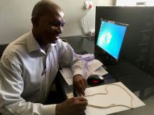
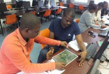
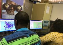
Educators were given a memory stick that contained the open software QGIS and SAEON data sets that were preloaded. The first day of the workshop began with educators gaining an insight into the concepts of GIS and engaging in paper-based activities that they can use at their schools if they do not have computer labs.
The second day was an introduction to QGIS software and the use of QGIS software to draw maps, identify different types of shape-files and activities to explore the concepts of layering and buffering. Outdoor activities included the use of a hand-held GPS to locate trees in the school yard and a drone to get an aerial photo of the school.
The workshop concluded with application activities that illustrated that GIS can be used to solve problems or issues through inquiry-based learning.
Evaluation of the workshop
A survey was conducted with educators that attended the workshop. From the surveys, 95% of educators indicated that they had never used a computer to teach GIS or had access to software to teach GIS. 100% of the educator attendees at the workshop felt that the GIS workshop implemented by SAEON was very beneficial and they could take the skills that they had learned into their classrooms.
Acknowledgements
The SAEON GIS Workshops for Educators would not have been possible without the support of SAEON scientist Hayden Wilson for SAEON data and editing of the training manual, senior technician Rion Lerm from the Ndlovu Node for inputs into the training manual and facilitation of the workshops, as well as their respective managers.